


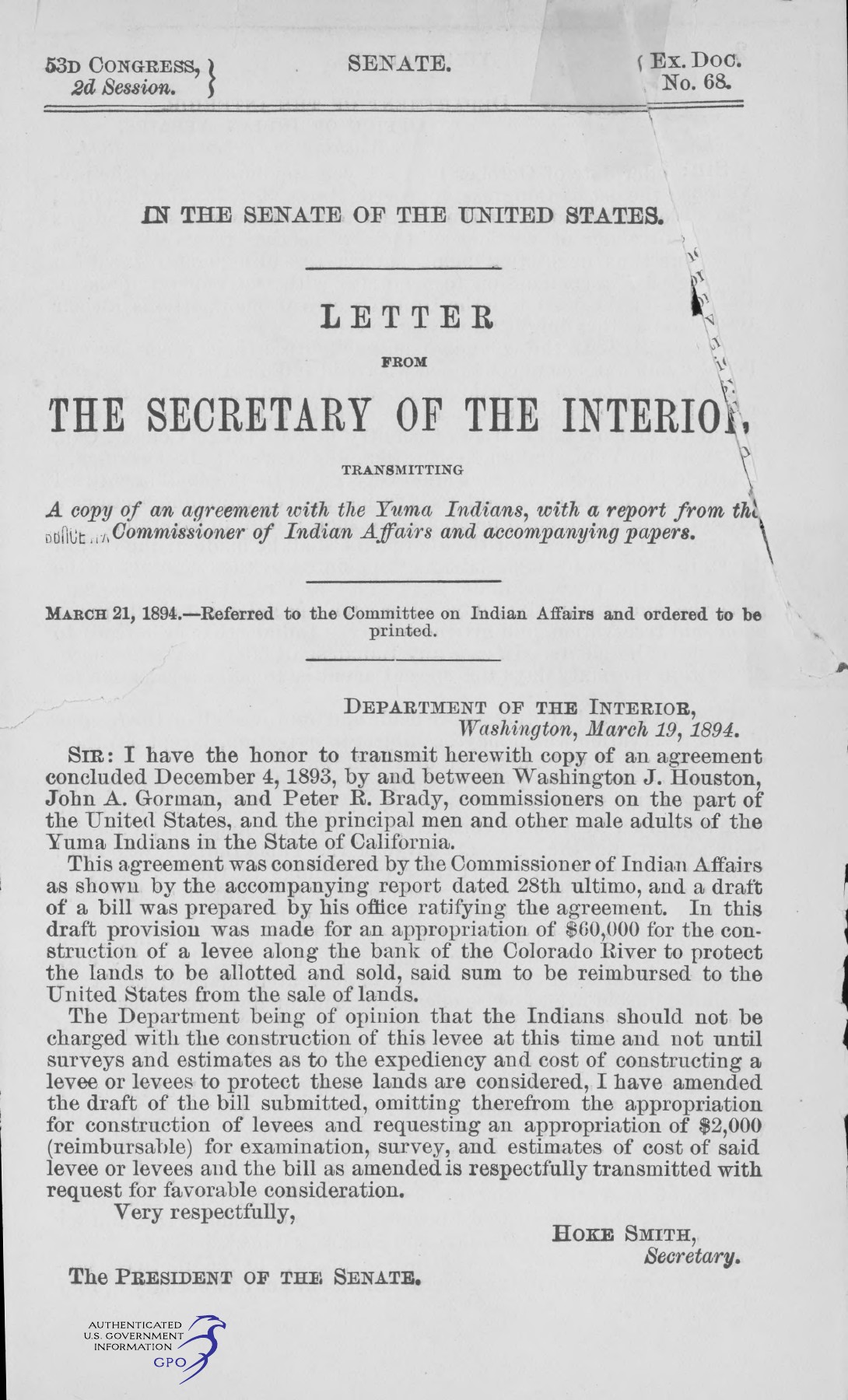
The document sent to the Senate in March 1894 contains much more than the agreement reached at Fort Yuma the previous December. It preserves the federal government's effort to explain, finance, and legislate an agricultural plan. The file includes reports, correspondence, a proposed bill, the agreement, and maps. Read together, these materials show officials working through an arrangement whose success depended on irrigation, flood protection, land sales, and administrative follow-through. [1]
The first page establishes two dates. Interior Secretary Hoke Smith's letter is dated March 19, 1894. The Senate referred the material to its Committee on Indian Affairs and ordered it printed on March 21. Those dates identify different steps in the same transmission. Neither changes the agreement's December 4, 1893 date or substitutes for Congress's later enactment in August 1894. [1] [2] [3]
For readers following the reservation's history, the file is a bridge between the negotiated text and the statute. It shows what officials told Congress, what they expected the arrangement to accomplish, and what questions remained open. It also requires care: a recommendation in this packet is evidence of a proposal, not proof that Congress enacted it or that the government later carried it out.
The first letter changes the financial proposal
Smith's opening letter explains that the Indian Affairs office had prepared a bill ratifying the agreement and included a $60,000 appropriation for construction of a levee along the Colorado River. That sum was to be reimbursed from land sales. Smith declined to transmit the proposal unchanged. He questioned charging the Indians for construction before surveys and estimates had established the expediency and cost of the works. [1]
Instead, the transmittal describes an amended request for $2,000, also reimbursable, for examination, survey, and cost estimates. That difference is revealing. The first page does not present a completed engineering plan with a settled price. It records a shift from proposed construction funding toward investigation of what protection would be needed and what it would cost.
The issue was tied directly to the agreement's promised benefits. If land sales were supposed to create a fund for the Tribe, reimbursing major works from those proceeds would affect the money remaining. Smith's letter makes the allocation of cost visible before ratification. It also shows why infrastructure provisions should be read as part of the land transaction's substance, rather than as an incidental improvement added after the important decisions were made.
The agricultural forecast behind the agreement
The accompanying report from the Commissioner of Indian Affairs summarized the eight articles and relayed the commissioners' estimates. It described a reservation estimated at 45,889 acres and a population reported by the commission as 706. It also reported an expectation that about 18,000 acres could be placed under irrigation, with approximately 3,600 acres needed for allotments and 14,400 left for appraisal and sale. [1]
Those numbers describe the commission's 1894 planning assumptions: an estimated reservation area, a reported population, and projected irrigable acreage. They do not establish the amount of land eventually brought under irrigation or the results of subsequent sales. Federal officials used those estimates to explain the arrangement's anticipated benefits when seeking congressional approval. The difference between expected development and completed performance would become a central issue in the later administrative dispute.
The report also described a possible sale return of roughly $600,000 based on selling about 12,000 acres at an average of $50 an acre. Its own phrasing treated those figures as contingent. The expected trust fund depended on selling something like the projected acreage at something like the projected price. Reading that forecast as if it were an audited receipt would turn an anticipated benefit into a historical fact the document does not establish.
Water was both the opportunity and the hazard
The reports treated access to irrigation as the basis for agricultural value. They referred to a proposed canal associated with the Colorado River Irrigation Company and the right-of-way legislation enacted in February 1893. The lands beneath that proposed canal were the ones the account expected to support allotment and sale. The projected economics depended on water reaching the land. [1]
Yet the same river could undermine the plan through flooding. The report described seasonal rises, channels and lagoons through which water spread, and the risk that inundation would occur when crops should be ripening. These observations supplied the case for levees. The plan required managing water in two directions: bringing enough to crops and preventing destructive overflow.
This relationship gives the packet its historical texture. The agreement's abstract categories—irrigable land, allotments, sale proceeds—were connected to a particular river landscape. The correspondence shows officials anticipating costs and risks that a short description of land cession can conceal. Those practical dependencies later mattered when lawyers asked whether the promised arrangement had ever been accomplished. [4]
The correspondence includes a rough estimate that levee work might require moving between 300,000 and 350,000 cubic yards of earth at about fourteen cents per yard, reaching approximately $49,000 at the upper estimate. The report presents this as preliminary information relayed through the planning discussions. It is not a final contract price or proof of a completed levee. [1]
The distinction helps explain the Secretary's decision to seek investigation before construction funding. Officials were trying to determine how to protect the lands whose agricultural value underpinned the proposed transaction. If flood protection proved more expensive or less certain than anticipated, the consequences would reach beyond engineering into land-sale proceeds and the benefits expected for the Tribe. The report makes that connection visible before Congress acted.
The maps come with their own qualifications
Two map sheets accompany the Senate reports. They place the proposed works within the river landscape and give geographic form to the officials' discussion of irrigation and flood protection. Their purpose was connected to the plan under consideration, including the relationship between potentially productive land and the water conditions affecting it. The correspondence qualifies the geographic information on which that planning depended. [1]
The correspondence is unusually useful on that point. In discussing information supplied for levee planning, the report relays that some sloughs shown on an accompanying map were accurately drawn while others were approximations. It also reports difficulty providing an approximate cost for permanent flood protection. The text therefore carries qualifications that can disappear when a map image circulates without the surrounding report.
That does not make the maps useless. It makes them historical planning evidence. They show how officials represented the landscape while considering the agreement. They should not be transformed into a modern survey or used to establish the exact legal status of a present parcel. The descriptions, map sheets, and qualifications belong together because they explain what kind of geographic evidence the packet actually offers.
Whose account the packet preserves
Much of the narrative is written by federal officials and commissioners. It summarizes the agreement, describes the commission's work, and presents the plan to another branch of the federal government. The file reports 203 adult male signatories out of 251 adult males and includes printed signatory material with the agreement. Those details are important evidence about the record presented to Congress. [1]
The commission's characterization of agreement, satisfaction, and expected benefits remains its account of the negotiations. The printed packet does not contain a complete set of individual narratives explaining why each signer participated or how each promise was understood. The reported signatures establish an important feature of the record presented to Congress, while leaving questions about individual experience beyond the scope of the officials' narrative. That difference reflects whose reports supplied most of the transmittal's explanation.
The agreement itself deserves separate attention within the packet. Its articles establish terms, while the reports explain and advocate a plan. Keeping those genres distinct helps a reader separate contractual language from administrative expectations. The later statute supplies another distinct layer: Congress's enacted directions, rather than the bill as proposed in a transmittal. [2] [3]
From negotiation to congressional action
Executive Document No. 68 of the Fifty-third Congress, second session, brought the negotiated agreement into the Senate's consideration in March 1894. Its contents connected several stages of federal decision-making: the commissioners' negotiations at Fort Yuma, the Indian Affairs office's proposed legislation, and Secretary Smith's response to the proposed construction expenditure. The packet therefore records an arrangement still being examined and revised before Congress enacted its ratification and implementing provisions that August. [1] [2] [3]
Executive Document No. 68 is valuable because it preserves the conversation around the agreement before ratification. The file shows financial projections being made, construction costs being questioned, flood risks being described, and legislative language being prepared. It does not establish that every expectation was fulfilled. Later Interior opinions would return to that distinction when examining the effect of the agreement and the government's performance. [4]
The agreement, the transmittal, and the ratifying statute mark successive stages in that process. The December articles set out the proposed exchange; the March correspondence explained its expected operation and questioned its costs; the August legislation supplied congressional approval and further directions. The government's expectations at the planning stage remained distinct from the results of later performance. That distinction eventually became central to Interior's reconsideration of the disputed lands. [2] [3] [4]
Sources
1. S. Exec. Doc. No. 68, 53d Cong., 2d Sess. (March 21, 1894). S. Exec. Doc. No. 68; transmittal and reports, pages 1–18, agreement, pages 19–22, and map sheets. Download PDF · Source publication · Source PDF (34 pages).
2. Agreement of December 4, 1893; S. Exec. Doc. No. 68, 53d Cong., 2d Sess., pp. 19–22 (1894). Articles I–VIII. Read source PDF · Source publication
3. Act of August 15, 1894, ch. 290, § 17, 28 Stat. 286, 332–336. Section 17; 28 Stat. 332–336. Read source PDF · Source publication
4. M-36908 (December 20, 1978), published at 86 I.D. 3–22 (1979). Historical account and analysis; 86 I.D. 3–22. Read source PDF · Source publication