


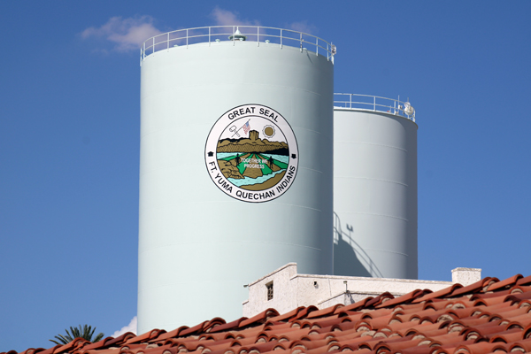
The Quechan Tribe's official location page gives a concise public description of the reservation: it is situated beside Arizona, California, and Baja California, encompasses approximately 45,000 acres, and is crossed in its southern area by Interstate 8. The page emphasizes the travel corridor linking Phoenix and San Diego. Its purpose is orientation—telling readers where the reservation is and how it sits within the surrounding region. [1]
The Tribe's own public description provides a perspective distinct from the federal documents that dominate much of the reservation's written administrative history. It describes a place and its regional connections, while executive orders, opinions, and decrees address particular governmental actions and disputes. The location page's emphasis on geography and travel situates the reservation in the surrounding region without purporting to resolve the legal questions addressed by those other instruments.
The brief description also opens questions that require other sources: how the reservation was established in federal records, how the river figures in its boundaries, and why different maps report different acreage. The related documents provide that context. Their role is to explain the history surrounding the Tribe's public description while keeping the webpage itself recognizable as a concise account of location, rather than attributing a detailed legal narrative to it.
A reservation and a broader ancestral homeland
The 2018 Tribal Water Study describes the reservation as encompassing part of the Quechan people's ancestral home. It connects earlier settlements and agriculture with the Colorado River floodplain and the river's seasonal patterns. That account distinguishes the people's relationship with the landscape from the later federal reservation instruments. [2]
The distinction is fundamental. The executive order of January 9, 1884 marks a federal action establishing the reservation described in that document. It does not mark the beginning of Quechan presence, identity, or history. A location article that starts with the order should make clear which historical question the date answers.
The Tribe's public location description and the study's broader geographic account can therefore coexist with the legal chronology. One orients readers to the reservation as a place; another explains aspects of the physical and cultural setting; the orders and later decisions trace federal treatment of particular lands. None needs to be forced into the role of a complete history by itself.
The Colorado River is the recurring reference
The Colorado River recurs in the reservation's history as a boundary reference, a source of irrigation, a setting for infrastructure, and the subject of interstate water litigation. Its presence connects documents written for very different purposes. The physical setting described in the water study helps explain why the same river appears both in short nineteenth-century descriptions and in the detailed terms of later agreements and decrees. [2] [3] [8]
The 1884 order used the river channel and surveyed lines to define the California reservation. Later documents dealt with irrigation works, former riverbed land, and administrative interests associated with water infrastructure. A regional description that places the reservation near three political jurisdictions captures the broad setting but not all of those historical distinctions.
This is why the river should be treated as more than a scenic backdrop. It shaped the questions the documents addressed: where land lay, how it could be cultivated, how infrastructure crossed it, and how much water the reservation was entitled to receive. The sources provide different parts of that account rather than one interchangeable geographic description.
The former fort and the reservation are related terms
The 1884 order separately addressed the abandoned Fort Yuma military reservation, transferring it to Interior for Indian purposes connected with the newly described reservation. The 1900 order then modified that transfer for the portion south of the Colorado River. These distinctions explain why references to Fort Yuma can identify related but legally different property arrangements. [3] [4]
The 2018 study locates the Tribe's headquarters on the old Fort Yuma grounds in California, across the river from the city of Yuma. That contemporary-to-the-study description helps readers orient themselves without erasing the older documents' separate treatment of military property and the Indian reservation. [2]
The names should therefore be read with their contexts. A historical military reservation, the Indian reservation, tribal headquarters, and the neighboring city are not identical geographic or legal concepts simply because Fort Yuma and Yuma recur in their descriptions. The source record provides the distinctions needed to tell the story accurately.
A transportation corridor through a lived landscape
Interstate 8 is prominent in the Tribe's public description because it places the reservation on a major route through the region. The 2018 study also identifies the highway and describes a reservation economy involving agriculture, tourism, businesses, housing, and public services. Those are features of a community and working landscape, not merely a location on a highway map. [1] [2]
The study's account is dated, so it should not be treated as a verified inventory of every facility or business operating today. Its historical value is to show how the reservation's physical connections and uses were described when the study was prepared. The official location page supplies the Tribe's more recent public orientation, with its displayed update date retained.
The planning map adds another perspective by showing roads, infrastructure, surrounding land-management categories, and other features selected for agency planning. It helps readers visualize the corridor but does not convert the highway reference into a determination of adjacent title or jurisdiction. Those remain questions for the relevant legal and geographic records. [6]
The 45,000-acre description is not the only reported figure
The Tribe's location page describes approximately 45,000 acres, as does the introduction to the 2018 water study. The 2017 BIA planning map gives a different total of 51,700.7 acres in its summary. These are figures from separate documents with different purposes. Their difference is visible in the sources, but the decimal precision of the map's total does not by itself explain the relationship between the descriptions. [1] [2] [6]
The available sources do not establish that the difference reflects a particular land addition, a loss, or a simple arithmetic mistake. Different purposes and data definitions may be relevant, but identifying the actual cause would require additional authoritative records. The responsible statement is that the sources report different acreage figures, each with its own context.
The map's draft status and disclaimer are particularly important. Its decimal figure should not be treated as a definitive title measurement merely because it appears more exact. Likewise, the public webpage's rounded figure is a description, not a parcel-by-parcel survey. Keeping those roles clear prevents a numerical disagreement from becoming an invented historical event.
The boundary documents contain more than an outline
The 1981 determination recognizes the reservation boundary through the 1884 order as modified in 1900, while also addressing trust status, third-party interests, federal works, and administrative conditions. Its detailed provisions show why a reservation description cannot always be reduced to a single acreage figure or an outer line. [5]
Rights of way, leases, utilities, and reclamation facilities appear in that record because the recognized area contained layered interests and uses. The determination addressed those relationships in a particular historical setting. It is not reproduced by a public location paragraph, nor is the paragraph deficient because it serves a different audience and purpose.
For a general reader, the useful progression is from location to context to legal detail. The Tribe's description establishes where the reservation is presented to the public. The map and study help explain the physical landscape. The orders, determination, and associated instruments answer narrower questions about federal actions and specific interests.
Older maps show different moments in the same region
The 1894 Senate transmittal includes maps accompanying the agreement and proposed agricultural development. Its reports discuss canals, flood protection, and uncertainties in the engineering information then available. These materials show a historical planning effort, not a timeless depiction of the region. [7]
Placed beside a modern public location description, the older maps reveal how different documents select different aspects of place. A congressional packet could emphasize proposed works and land disposition. A tribal website can emphasize regional location and access. A BIA planning sheet can emphasize infrastructure and management themes. Each is informative when its purpose remains visible.
The comparison also helps explain why source attachments matter. A small map or short quotation can lose its date, legend, or qualifications when copied elsewhere. Preserving the complete document lets readers examine the conditions under which a geographic statement was made instead of relying only on its appearance in a later narrative.
A place described by the Tribe, with evidence for the surrounding history
The location page carries a displayed update date of August 11, 2025. Its public description emphasizes the reservation's regional position and transportation connections. Those subjects are different from the operative boundaries and qualifications in executive orders, or the allocations in a water decree. The Tribe's account gives the place its own public introduction, while the historical instruments explain specific actions that shaped its federal administrative and legal history. [1]
The reservation's location at the California-Arizona-Mexico meeting area helps explain why the records cross state, federal, and international geographic references. The water decree's state schedules are one example of that complexity, while the founding order and later modification supply others. Those relationships enrich the location account without requiring the short webpage to prove every legal detail. [3] [4] [8]
The resulting picture is of a specific place with a longer history than any one federal instrument. The Tribe's description remains the starting voice for public orientation. The related documents then show how land, water, infrastructure, and administration became the subjects of decisions and disputes. Together they offer readers both a sense of where the reservation is and a grounded way to explore the history behind that description.
Sources
1. Location, official tribal website; page updated August 11, 2025, retrieved October 25, 2026. Official Location page; displayed update August 11, 2025. Download PDF · Source publication · PDF copy of published webpage (2 pages).
2. Colorado River Basin Ten Tribes Partnership Tribal Water Study, Chapter 5.9: Quechan Indian Tribe (December 2018). Sections 5.9.1–5.9.3; geography, ancestral homeland, and physical setting. Read source PDF · Source publication
3. Executive Order of January 9, 1884; Executive Orders Relating to Indian Reserves (1902), p. 35. January 9, 1884 reservation description and military-property transfer. Read source PDF · Source publication
4. Executive Order of December 19, 1900; American Presidency Project web edition. December 19, 1900 modification. Read source PDF · Source publication
5. 46 Fed. Reg. 11,372–11,376 (February 6, 1981); signed January 30, 1981. Determination and directives; 46 Fed. Reg. 11,372–11,376. Read source PDF · Source publication
6. Quechan Planning Map, July 6, 2017 (file date); marked DRAFT. Draft planning map and acreage summary. Read source PDF · Source publication
7. S. Exec. Doc. No. 68, 53d Cong., 2d Sess. (March 21, 1894). Historical reports and maps. Read source PDF · Source publication
8. Arizona v. California, 547 U.S. 150 (2006), decree entered March 27, 2006. Water-rights provisions and state schedules. Read source PDF · Source publication